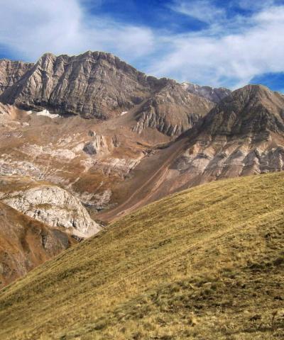
Environmental challenges and associated risks, the search for diversified and sustainable sources of energy, and land-use planning from land to sea, are at the heart of sedimentary geosciences.
The challenges of geo-energy and climate risks
By combining sedimentary, structural and marine geology, reservoir analysis and geo-modeling, the engineers trained will be able to identify energy resources, both fossil (hydrogen, uranium, hydrocarbons) and renewable (geothermal, marine energies), and the possible mixes within a territory undergoing an energy transition.
These engineers will be able to implement geological solutions for carbon offsetting, as well as assess risks and propose solutions for adapting to natural hazards accentuated by human activities (coastal erosion/retreat, impacts of floods and storms), right through to optimizing developments from the coast to submerged areas.
Last but not least, environmental protection and the enhancement of geological heritage are fundamental aspects of these engineers' work.
Course details
Subsurface DATA major
The major corresponds to course-specific teaching. It consists of course sequences and projects.
- Sampling and subsurface data analysis
- Near- and subsurface geophysical methods
- Project: Introductory Research Thesis 1
minors
Each semester includes 2 blocks dedicated to minors, corresponding to 54 hours of complementary teaching that enable students to complete their training in a related field.
Proposed minors
Block 1: Identification of Geo, Bio Energies (Label Géo-bio énérgies) / Seaworld Mapping and Understanding / Automated data processing : Python programming and Numerical methods, Python and advanced methods / Scientific approach - Research - Beginner / Innovate, undertake and combat creaticide attitudes
Block 2: Advanced Spatial Analysis: Advanced spatial data processing (remote sensing, Python automation, 3D, Data Model, Web diffusion) on ArcGIS / Scientific approach - Research - Beginner
MAjor Sedimentary and marine geosciences
- Geological and Geophysical interpretation and synthesis
- Sequence Stratigraphy
- Projet: Mémoire d’Initiation à la Recherche 2
minors
Each semester includes 2 blocks dedicated to minors, corresponding to 54 hours of complementary teaching that enable students to complete their training in a related field.
Proposed minors
Block 1: MREs and Coastal Development / Quantification and production of Geo, Bio Energies (Label Géo-bio énérgies) / Scientific approach - Research - Intermediate / Sales techniques and commercial relations / Project management: From forecast to agile / Introduction to the Web: Developing a website
Block 2: Innovation, Carbon neutrality and Territories (Label Géo-bio énérgies) / 3D modeling: Designing 3D parts using Dassault Système solutions and 3D printing / Management and applications in Geoenergy and Geotechnics / Scientific approach - Research - Intermediate / Immersive entrepreneurship and design thinking
In semester 9, you can choose to follow your own path by selecting from :
- the main major of the Geo-energies, climatic Risks and Territories pathway, which goes into greater depth in this field (subject to change): Geomodelisation, geo-energies and oceanography. This major includes the group project "Land-Sea Field School: boarding a French Oceanographic Fleet vessel, the NO Téthys 2".
- one or more opening majors, designed to broaden your skills in another field (subject to change):
- Digital applied to geosciences
- QHSE, CSR, Risk manager
- Intrapreneurship, entrepreneurship and innovation
- a semester, a double degree or a degree-granting stay in France or abroad (from 12 to 18 months for a double degree or a degree-granting stay)
The Land-Sea Field School puts students in the shoes of a scientific crew on a multi-track marine seismic acquisition campaign on a French Oceanographic Fleet vessel, the NO Téthys 2.
Their mission?
- Prepare the acquisition plan according to precise scientific objectives,
- operate the equipment,
- liaise with the sailors,
- supervise acquisition, organized by watch.
The final project is based on an in-company work placement or research placement for students, or on the long period spent in a company for apprentices.
A final dissertation is written and presented orally.
What are the career options after Geo-energies, climatic Risks and Territories?
The Geo-energies, climatic Risks and Territories pathway enables you to work in renewable and fossil energy exploration and production, storage (gas, CO2, waste, etc.), drilling, coastal management, marine campaigns, geophysical acquisitions, industrial cabling, research and development and services.
some professions
- Design engineer / technical support
- Research / business engineer
- Project or team leader
- Coastal studies / research / mission manager
- Geosciences modeler
- Hydrographer
They welcome our engineers
45-8, ADEME, BAKER HUGHES, BEICIP, BRGM, CEREMA, CVA, ELIIS, ENGIE, EOLFI, EQUINOR, ESRI, EXXON, FRANCE ENERGIES MARINES, FUGRO, GEOLOG INT., GEOSTOCK, GEOXYZ, IFREMER, LDA, MAUREL & PROM, MODIS, ORANO, PERENCO, SAIPEM, SCHLUMBERGER, SPINERGIE, STORENGY, TOTALENERGIES, UNESCO, VERMILION …